Fisher Maps
MINNESOTA-CANADIAN WILDERNESS
MINNESOTA-CANADIAN WILDERNESS
Regular price
$19.95 USD
Regular price
Sale price
$19.95 USD
Unit price
per
Shipping calculated at checkout.
Couldn't load pickup availability
Free USA Shipping
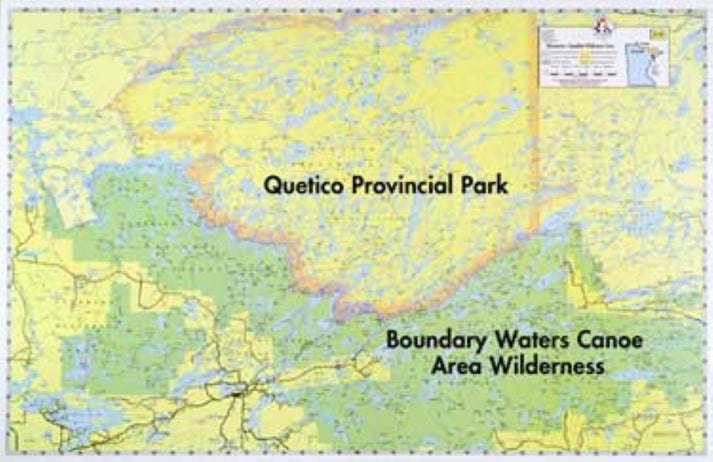
- A comprehensive map of the area within and surrounding the Boundary Waters Canoe Area, from Crane Lake on the West to Gunflint Lake on the East. Also designated are the Superior National Forest, Canada’s Quetico Provincial Park, B.W.C.A., and international boundaries. Outboard motor routes within the B.W.C.A. are shown.
- Type: Wall Map
- Subtype: Fishing
- Language: English
- Scale: 1:190080
- Regions Covered: Midwest, North America
- Countries Covered: Canada, United States
- States Covered: Minnesota, Ontario
- UPC: 689076822237
- MPN: E-15
- Folded Size: N/A
- Unfolded Size: 34" (W) x 22" (H)
- Weight: 1 lb