Captain Segulls
Bathymetric Massachusetts and Cashes Ledge-IC209 Large
Bathymetric Massachusetts and Cashes Ledge-IC209 Large
Regular price
$19.99 USD
Regular price
Sale price
$19.99 USD
Unit price
per
Shipping calculated at checkout.
Couldn't load pickup availability
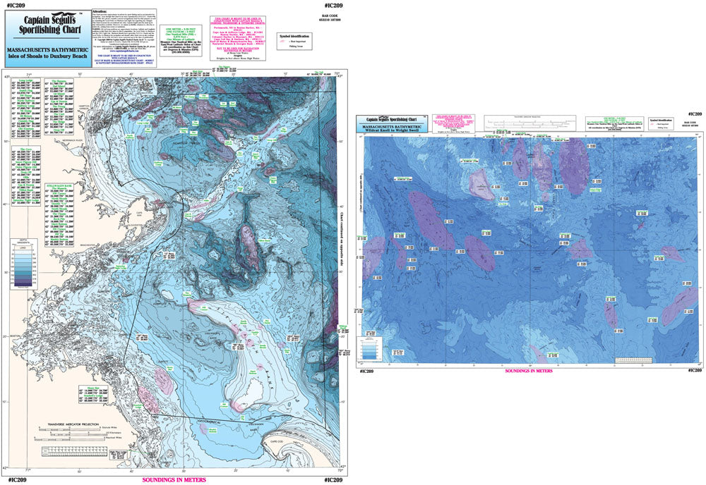
Bathymetric - color contoured by depth - double sided, laminated, 19 x 26 inches, Massachusetts Bay area
Nearshore Bathymetric Chart side A: Isle of Shoals, New Hampshire to Duxbury Beach, MA, east to Wildcat Knoll with Stellwagen Bank. Side B: Wildcat Knoll to Wright Swell, north to Cashes Ledge to Franklin Swell. All charts include GPS coordinates, wrecks, reefs, shoals, fishing areas, amenities and restrictions. You should use this chart in conjunction with our NOAA based charts.