East View
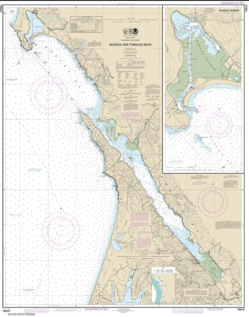
Bodega and Tomales Bays; Bodega Harbor (18643-18) by NOAA Nautical Chart
Bodega and Tomales Bays; Bodega Harbor (18643-18) by NOAA Nautical Chart
Regular price
$30.95 USD
Regular price
Sale price
$30.95 USD
Unit price
per
Shipping calculated at checkout.
Couldn't load pickup availability
Free USA Shipping
Our Bodega and Tomales Bays; Bodega Harbor nautical chart (Map Index 18643) is printed using high resolution, heavy weight and acid free paper.
Map Size: 43.54 x 34.330 inches
All charts are printed with the latest Notice to Mariners (NTMs) and meet United States Coast Guard and international carriage requirements for commercial and recreational vessels. .
All NOAA nautical charts ship rolled in protective tube