East View
Eleuthera - West Part (NGA-26306-14) by National Geospatial-Intelligence Agency
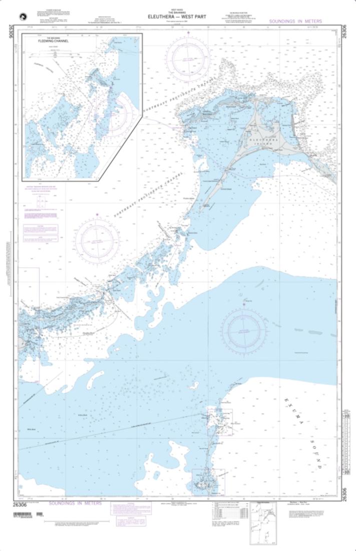
Eleuthera - West Part (NGA-26306-14) by National Geospatial-Intelligence Agency
Regular price
$30.95 USD
Regular price
Sale price
$30.95 USD
Unit price
per
Shipping calculated at checkout.
Couldn't load pickup availability
Free USA Shipping
Eleuthera - West Part (NGA-26306-14) by National Geospatial-Intelligence Agency nautical chart are printed using high resolution, heavy weight and acid free paper.
Map Size: 33 x 51 inches
All NGA nautical charts ship rolled, and are printed by East View Map Link, LLC. Magnetic variation provided; Bathymetry by contours at intervals as small as 2 meters with spot depth in meters; shallow coastal water in blue; lighthouses, buoys, wrecks, submerged and awash rocks, obstructions, submarine cables, pipelines, islands, and islets shown; Larger-scale maps in the series show shore characteristics (sandy, rocky, cliffs), bridges, and harbor features (piers, wharfs, jetties, breakwaters).