Captain Segulls
FL/AL Pensacola, FL and Mobile Bay, AL-PM47 Large
FL/AL Pensacola, FL and Mobile Bay, AL-PM47 Large
Regular price
$19.99 USD
Regular price
Sale price
$19.99 USD
Unit price
per
Shipping calculated at checkout.
Couldn't load pickup availability
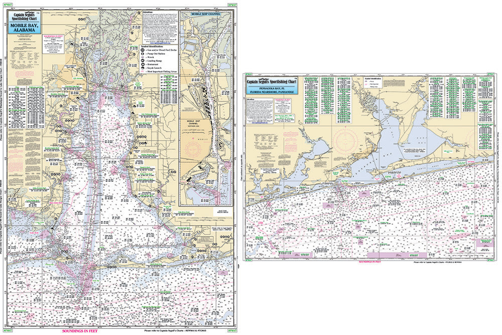
Florida and Alabama Gulf Coast
Nearshore 20 - 30 miles off. Chart is 19 x 26 inches double sided and laminated Florida and Alabama coastline
Side A: from Romar Beach west to Bayou La Batre, includes all of Mobile Bay and an inset of the Mobile Ship Channel northern end. Side B: from Wynne Haven Beach west to Romar Beach, includes Santa Rosa Sound, Pensacola Bay and Perdido Bay. All charts include wrecks, reefs, rigs, shoals, fishing areas, amenities and restrictions. Please refer to our nearshore, offshore, and small boat/kayak charts in this area.Uses NOAA Chart 11376 & 11382