Skip to product information
1 of 1

Captain Segulls

Florida Tampa Bay-TMB135 Large

Florida Tampa Bay-TMB135 Large

Regular price $19.99 USD
Regular price Sale price $19.99 USD
Sale Sold out
Shipping calculated at checkout.

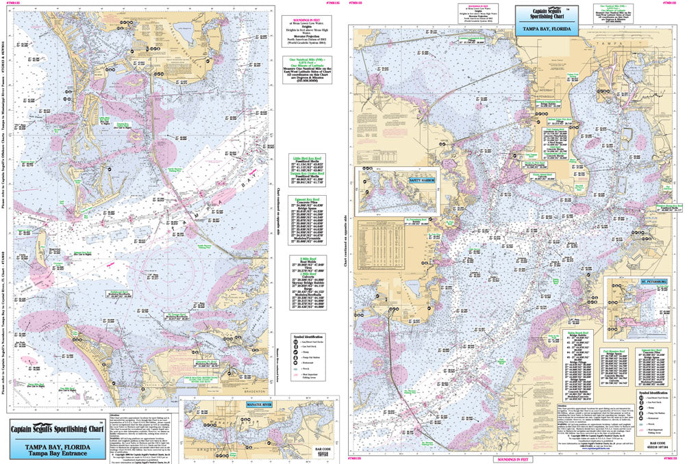
Florida Gulf Coast

An inshore chart 1-2 miles off the coast, detailing the bay. Chart is 19 x 26 inches, double sided, and laminated. Florida coastline

Side A: entrance of the bay in great detail, with an inset of Manatee River. Side B: Tampa Bay, Hillsborough Bay and Old Tampa Bay with insets of Safety Harbor and St. Petersburg. All charts include wrecks, reefs, shoals, rigs, fishing areas, amenities and restrictions. Also refer to our nearshore, inshore, offshore and small boat/kayak charts in this area. Uses NOAA Chart 11415 & 11416

View full details