Fisher Maps
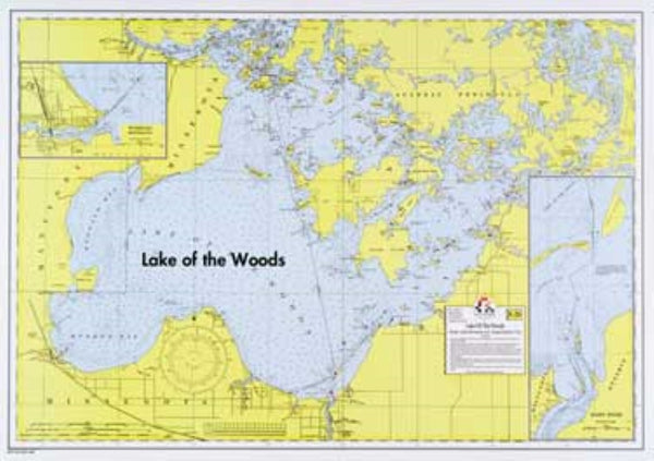
Lake of the Woods Southern Wall Map
Lake of the Woods Southern Wall Map
Regular price
$20.95 USD
Regular price
Sale price
$20.95 USD
Unit price
per
Shipping calculated at checkout.
Couldn't load pickup availability
Free USA Shipping
Detailed map of the southern portion of Lake of the Woods. Water depths are shown for the southwestern portion of the lake, and there are enlarged insets of the river access points at Warroad and Baudette. All of the Northwest Angle is shown.
Type: Wall Map
Subtype: Fishing
Language: English
Scale: 1:144000
Regions Covered: Midwest, North America
Countries Covered: Canada, United States
States Covered: Minnesota, Ontario
MPN: E-26
Folded Size: N/A
Unfolded Size: 28.5" (W) x 20" (H)
Weight: 1 lb