Captain Segulls
Ma/Ct/Ri/Ny Canyon chart off MA, RI, CT, NY-OF10 Large
Ma/Ct/Ri/Ny Canyon chart off MA, RI, CT, NY-OF10 Large
Regular price
$19.99 USD
Regular price
Sale price
$19.99 USD
Unit price
per
Shipping calculated at checkout.
Couldn't load pickup availability
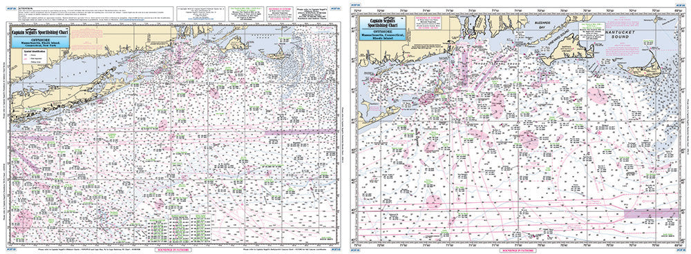
Offshore - 90 to 100 miles off coast, Double sided, laminated, 19 x 26 inches. MA, RI, CT, & NY.
Side A: from Nantucket Shoals to mid Long Island, NY south to cover all canyons beginning with the Veatch Canyon to Hudson Canyon. Side B: a blow up of the very important fishing spots off Block Island Sound, including the Dump, The Finger's Cox's Ledge and many more. You don't have to purchase both the OF10 and the OFGPS18, they cover the same area. The OF10 is blown up for people that are going out of Montauk, RI, CT and MA. Please refer to our nearshore, inshore, offshore, bathymetric and small boat/kayak charts in this area. Uses NOAA Chart 12300