East View
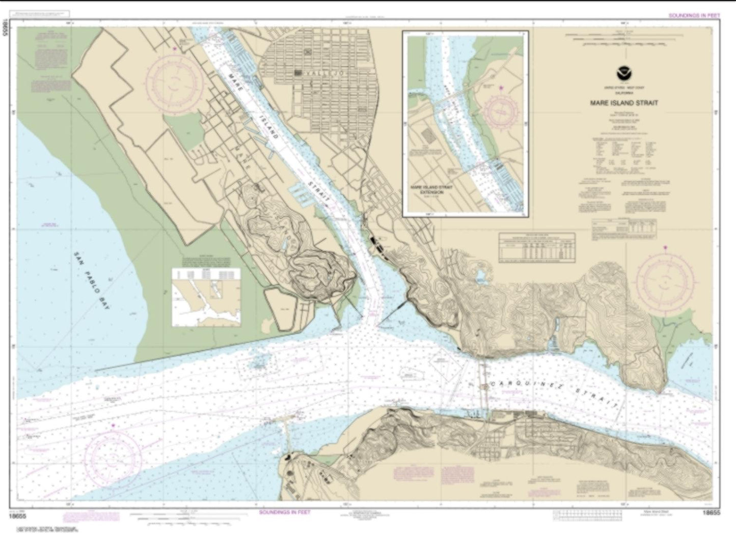
Mare Island Strait (18655-59) by NOAA Nautical Chart
Mare Island Strait (18655-59) by NOAA Nautical Chart
Regular price
$30.95 USD
Regular price
Sale price
$30.95 USD
Unit price
per
Shipping calculated at checkout.
Couldn't load pickup availability
Free USA Shipping
Mare Island Strait nautical chart (Map Index 18655) are printed using high resolution, heavy weight and acid free paper.
Map Size: 33.28 x 45.750 inches
All charts are printed with the latest Notice to Mariners (NTMs) and meet United States Coast Guard and international carriage requirements for commercial and recreational vessels. .
All NOAA nautical charts ship rolled in protective tube