Captain Segulls
Maryland Middle Chesapeake Bay-CBM119 Large
Maryland Middle Chesapeake Bay-CBM119 Large
Regular price
$19.99 USD
Regular price
Sale price
$19.99 USD
Unit price
per
Shipping calculated at checkout.
Couldn't load pickup availability
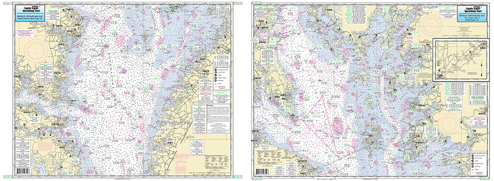
Maryland
An inshore chart 1-2 miles off the coast detailing the bay. Chart is 19 x 26 inches, double sided, and laminated. Middle Chesapeake Bay
Side A: covers from Cove Point, MD to Smith Point, VA, with an continuation of Pocomoke River. Side B: from Smith Point to Wolf Trap, VA. All charts include GPS coordinates, wrecks, reefs, shoals, fishing areas, amenities and restrictions. Please refer to the upper and lower bay charts and our small boat/kayak charts. NOAA Charts 12225 & 12230