Captain Segulls
Maryland Upper Chesapeake Bay-CBU120 Large
Maryland Upper Chesapeake Bay-CBU120 Large
Regular price
$19.99 USD
Regular price
Sale price
$19.99 USD
Unit price
per
Shipping calculated at checkout.
Couldn't load pickup availability
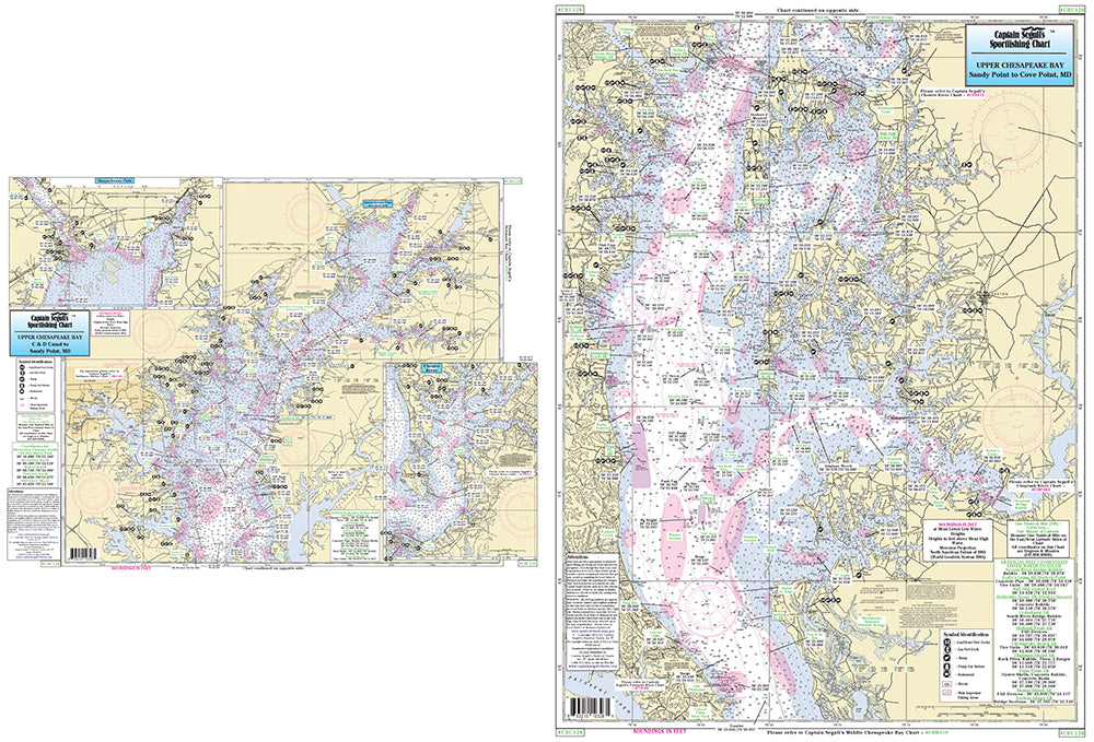
Maryland
An inshore chart 1-2 miles off the coast, detailing the bay. Chart is 19 x 26 inches, double sided, and laminated. Upper Chesapeake Bay
Side A: extends from the C & D Canal to Sandy Point, MD, with an inset of the Susquehanna River Flats and Northeast River. Side B: from Sandy Point, MD to Cove Point. MD. C & D Canal is on the DEL117 chart. All charts include GPS coordinates, wrecks, reefs, shoals, fishing areas, amenities and restrictions. Also refer to other Chesapeake and Delaware Bay charts. NOAA Charts 12263 & 12273