Captain Segulls
ME/NH/Mass Gulf of Maine, Massachusetts Bay-GMM17- Large
ME/NH/Mass Gulf of Maine, Massachusetts Bay-GMM17- Large
Regular price
$19.99 USD
Regular price
Sale price
$19.99 USD
Unit price
per
Shipping calculated at checkout.
Couldn't load pickup availability
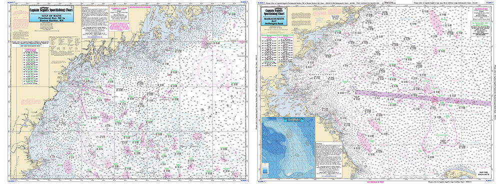
Maine Massachusetts Coast
Offshore chart off 90 to 100 miles off coast, double sided, laminated, 19 x 26 inches, Maine, New Hampshire, and Massachusetts,
Offshore chart, Side A, the Gulf of Maine from Penobscot Bay to Boston, Massachusetts Bay, includes an inset of Portland Harbor, ME. Side B, Massachusetts Bay, Boston south to Provincetown and Duxbury, MA includes a bathymetric inset of Stellwagen Bank. Please refer to our inshore, nearshore, offshore, bathymetric and small boat/kayak charts in this area. Uses NOAA Charts 13260 & 13267