Fisher Maps
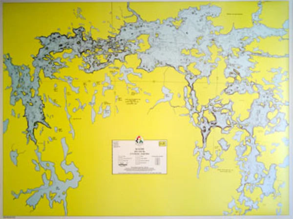
Minn/Ont LAC LA CROIX – HYDROGRAPHIC
Minn/Ont LAC LA CROIX – HYDROGRAPHIC
Regular price
$15.95 USD
Regular price
Sale price
$15.95 USD
Unit price
per
Shipping calculated at checkout.
Couldn't load pickup availability
Free USA Shipping
- A depth map of Lac La Croix based on soundings taken by the state in 1976. Lake bottom contours are shown in 10-foot intervals in both U.S. and Canadian waters
- Type: Wall Map
- Subtype: Fishing
- Language: English
- Scale: 1:63360
- Regions Covered: Midwest, North America
- Countries Covered: Canada, United States
- States Covered: Minnesota, Ontario
- MPN: E-25
- Folded Size: N/A
- Unfolded Size: 34" (W) x 22.38" (H)
- Weight: 1 lb