Navionics
(MN) Upper & Lower Prior and Waconia fishing map
(MN) Upper & Lower Prior and Waconia fishing map
Regular price
$25.99 USD
Regular price
Sale price
$25.99 USD
Unit price
per
Shipping calculated at checkout.
Couldn't load pickup availability
Free USA Shipping
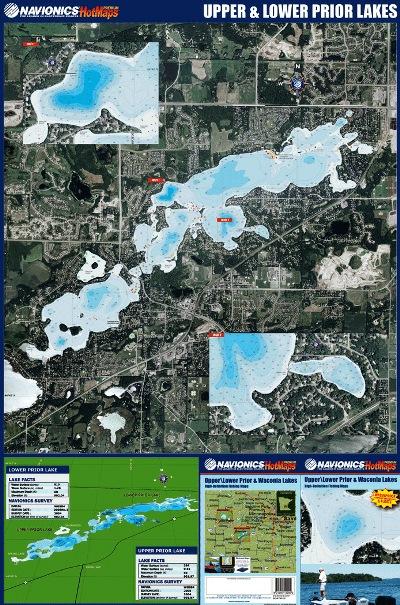
Navionics Fishing Maps. Using advanced computerized hydrographic survey technology, Navionics collected thousands of man-hours of data including water depth, lake bottom characteristics, sonar imagery and global positioning points for selected lakes across the country. The data, ranging from several hundred thousand to several million data points per map, is edited to create highly detailed lake bottom fishing maps.
Features of the lake maps.
- Color shaded depth contours.
- Major routes and highways.
- Double-sided with detailed area insets.
- Area points-of-interest.
- Top-down satellite photo overlay.
- Tear resistant.
- 3D lake overview.
- Water resistant or water proof.
- Measures approximately 24" x 36" - folds to small booklet size.