Captain Segulls
Nc/Va Coastal Virginia to North Carolina and Lower Chesapeake Bay-CBL22 Large
Nc/Va Coastal Virginia to North Carolina and Lower Chesapeake Bay-CBL22 Large
Regular price
$19.99 USD
Regular price
Sale price
$19.99 USD
Unit price
per
Shipping calculated at checkout.
Couldn't load pickup availability
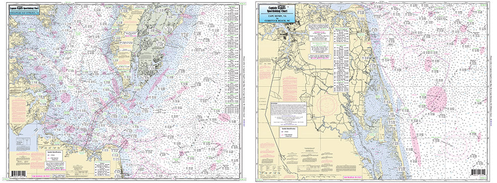
North Carolina/Virgina Coast
Nearshore 20 - 30 miles off. Chart is 19 x 26 inches, double sided, and laminated. Virginia and North Carolina coastline.
Side A: the Chesapeake Bay entrance in Virginia as far north to Ware Neck, Old Town Neck and Hog Island Bay. Side B: from Cape Henry, VA to Currituck Beach Light, NC, with an inset of Lynnhaven Bay and Roads. All charts include wrecks, reefs, shoals, fishing areas, amenities and restrictions. Please refer to our other Chesapeake Bay, nearshore, offshore, and small boat/kayak charts in this area.Uses NOAA Charts 12207 & 12221