Captain Segulls
Nc/Va/Md/De/Nj Cape May, NJ to Cape Hatteras, NC-CMCH20-Large
Nc/Va/Md/De/Nj Cape May, NJ to Cape Hatteras, NC-CMCH20-Large
Regular price
$19.99 USD
Regular price
Sale price
$19.99 USD
Unit price
per
Shipping calculated at checkout.
Couldn't load pickup availability
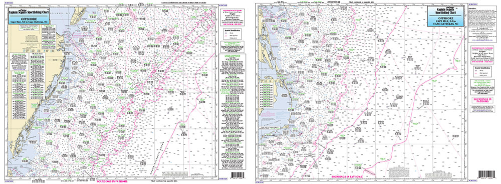
North Carolina to New Jersey Coast
|
Offshore chart 90 to 100 miles off coast, Double sided, laminated, 19 x 26 inches. New Jersey to North Carolina |
|