Captain Segulls
Offshore Canyon chart off MA, RI, CT, NY, NJ-OFGPS18 Large
Offshore Canyon chart off MA, RI, CT, NY, NJ-OFGPS18 Large
Regular price
$19.99 USD
Regular price
Sale price
$19.99 USD
Unit price
per
Shipping calculated at checkout.
Couldn't load pickup availability
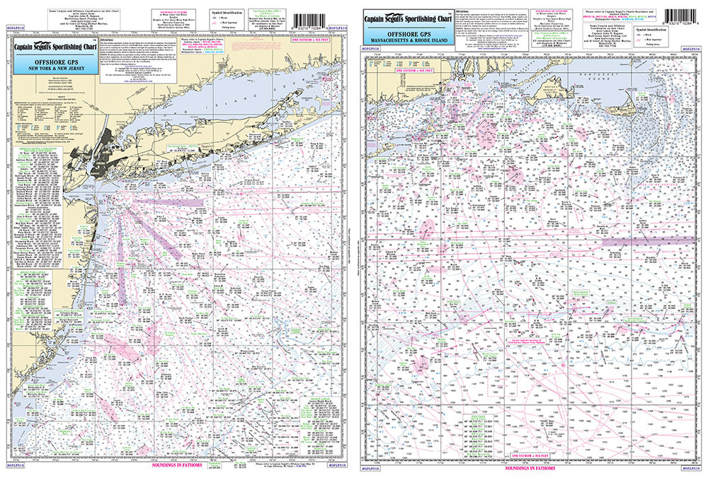
Offshore chart off MA, RI, CT, NY, & NJ, 90 to 100 miles off coast, Double sided, laminated, 19 x 26 inches.
Side A: Nantucket Shoals to tip of Montauk, NY, south to cover all canyons beginning with the Veatch Canyon. Side B: extends from Montauk to Five Fathom Bank off Cape May, NJ, west to Lindenkohl Canyon. This chart has sister charts the ONJ19 and ONY59. All charts include GPS coordinates, wrecks, reefs, shoals, fishing areas, amenities and restrictions. Please refer to our nearshore, inshore, bathymetric and offshore charts in this area. Uses NOAA Chart 12300