East View
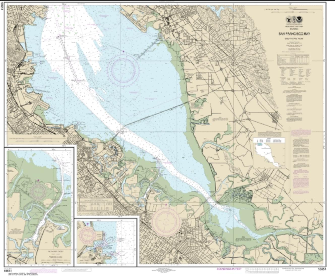
San Francisco Bay-southern part; Redwood Creek.; Oyster Point (18651-45) by NOAA Nautical Chart
San Francisco Bay-southern part; Redwood Creek.; Oyster Point (18651-45) by NOAA Nautical Chart
Regular price
$30.95 USD
Regular price
Sale price
$30.95 USD
Unit price
per
Shipping calculated at checkout.
Couldn't load pickup availability
Free USA Shipping
San Francisco Bay-southern part; Redwood Creek.; Oyster Point (18651-45) by NOAA nautical chart are printed using high resolution, heavy weight and acid free paper.
Map Size: 35.48 x 42.860 inches
All charts are printed with the latest Notice to Mariners (NTMs) and meet United States Coast Guard and international carriage requirements for commercial and recreational vessels. .
All NOAA nautical charts ship rolled in protective tube