NATIONAL GEOGRAPHIC MAPS
Shipwrecks of the Delmarva Peninsula Laminated Chart
Shipwrecks of the Delmarva Peninsula Laminated Chart
Couldn't load pickup availability
Free USA Shipping
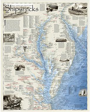
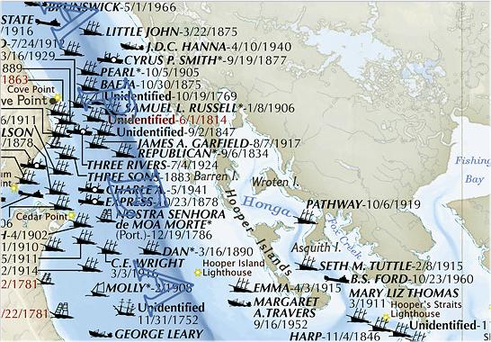
National Geographic Maps, 2010. Shipwrecks of Delmarva shows the location of over 2,400 wrecks from the waters off the Delaware coast to the waters of the Chesapeake Bay, displayed atop beautiful bathymetric and coastal detail. Each wreck site is symbolized to define the class, type, and name of vessel accompanied by their dates of sinking. Locations of lifesaving stations, lighthouses and lightships, along with navigational beacons are accurately marked. Bathymetric and coastal features are clearly labeled, accompanied by inset maps, captions, and drawings used to highlight unique historical events such as the sinking of the U.S.S. Cumberland, the German U-Boat offensives, and the ghost fleet of Mallows Bay - the largest assemblage of wooden ships in the Western Hemisphere. Size is 28 x 35 inches.