Captain Segulls
Texas Laguna Southern Madre-LMS52 Large
Texas Laguna Southern Madre-LMS52 Large
Regular price
$19.99 USD
Regular price
Sale price
$19.99 USD
Unit price
per
Shipping calculated at checkout.
Couldn't load pickup availability
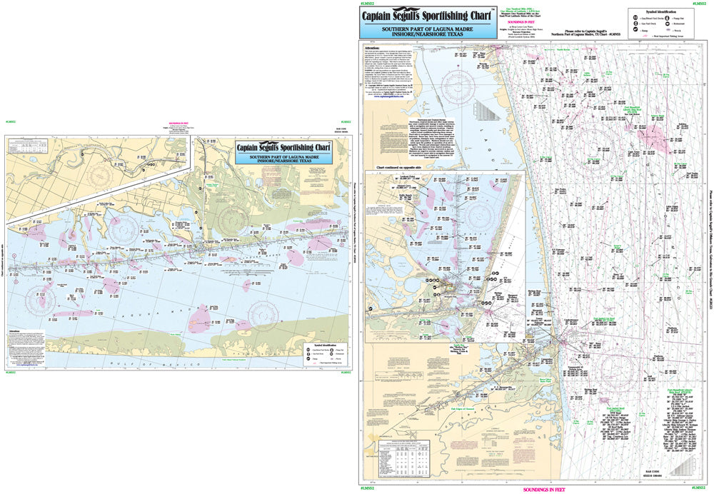
Texas Gulf Coast
One side of the chart cover 20 - 30 miles off the coast the other side of the chart covers 1 -2 miles with details of the bays. Chart is 19 x 26 inches, double sided, and laminated, Texas Coast line.
Side A: Nearshore chart from Rio Grande to the Port Mansfield channel, with inset of Port Isabel Area. Side B: Inshore/ICW chart from Stover Point to Chubby Island, with inset of the Arroyo Colorado. All charts include GPS coordinates, rigs, wrecks, reefs, shoals, fishing areas, amenities and restrictions. Please refer to our offshore chart in this area.