Captain Segulls
Texas Matagorda to Aransas Pass-MAP56 Large
Texas Matagorda to Aransas Pass-MAP56 Large
Regular price
$19.99 USD
Regular price
Sale price
$19.99 USD
Unit price
per
Shipping calculated at checkout.
Couldn't load pickup availability
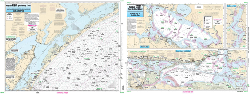
Texas Gulf Coast
One side of the chart cover 20 - 30 miles off the coast the other side of the chart covers 1 -2 miles with details of the bays. Chart is 19 x 26 inches, double sided, and laminated, Texas Coast line.
Side A: Nearshore 20 to 30 miles off the shore, Matagorda Light to Aransas Pass. Side B: Inshore/ ICW Carlos Bay to Redfish Bay & Capano Bay with an inset of St Charles Bay. All charts include GPS coordinates, wrecks, reefs, rigs, shoals, fishing areas, amenities and restrictions. Please refer to our offshore chart in this area. Uses NOAA Charts 11313, 11314