HUBBARD SCIENTIFIC
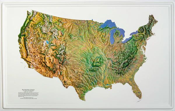
United States Satellite Image Raised Relief Map Does not include HI and AK
United States Satellite Image Raised Relief Map Does not include HI and AK
Regular price
$94.99 USD
Regular price
Sale price
$94.99 USD
Unit price
per
Shipping calculated at checkout.
Couldn't load pickup availability
Free USA Shipping
- This raised relief map of the U.S. shows physical features a satellite image as the base map.
- Type: Flat Map
- Subtype: Raised Relief
- Language: English
- Scale: 1:250,000
- Regions Covered: North America
- Countries Covered: United States
- MPN: 438
- Folded Size: N/A
- Unfolded Size: 23" (W) x 36.25" (H)